coincidentcontrolpoints.md 1.5 KB
Why do we need to overlap geographic and local coordinates?
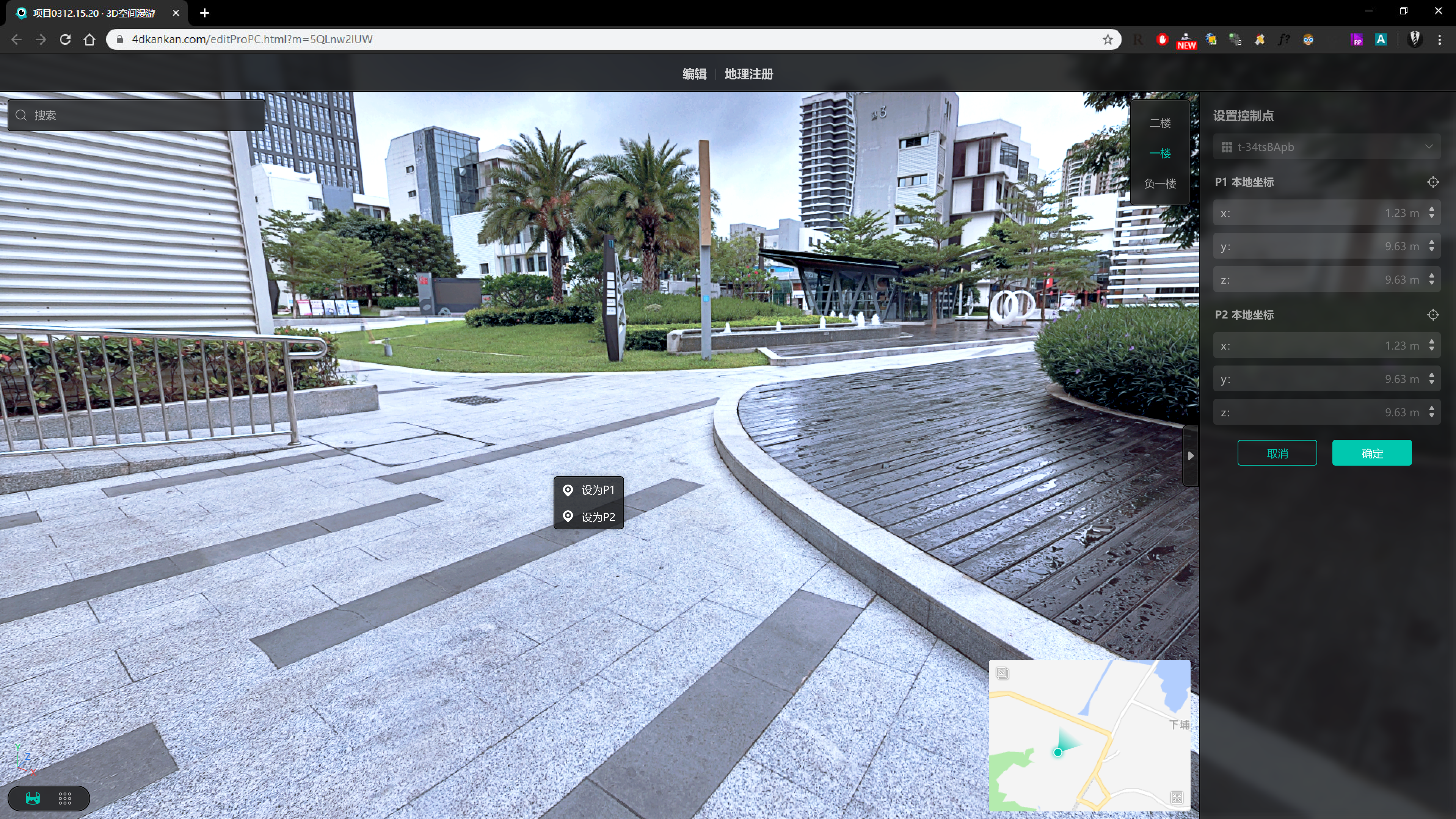
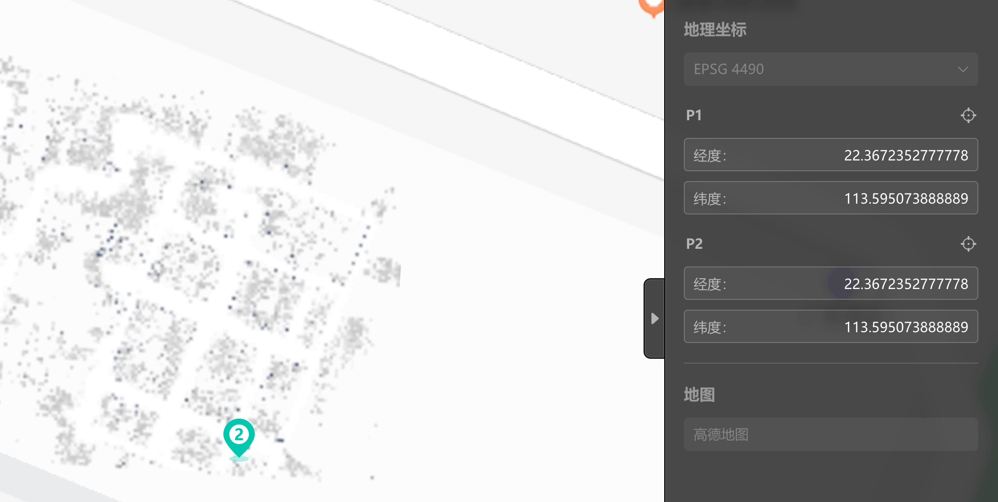
We have selected two local coordinates on the dataset (generated using the scene captured by the Mega scanner), and in order to reflect the dataset to the map, we must input the geographic coordinates of these two local coordinates in order to place them on the map, with the local and geographic coordinates overlapping. As shown in the following image:

How do geographic and local coordinates overlap?
Please ensure that the local and geographic coordinates correspond perfectly to avoid inaccuracies. If not, please enter the correct geographic coordinates in the input box (as represented in the figure below) to remove the warning.
 If you have verified that the geographic coordinates are accurate, please verify that the local coordinates are accurate as well. Click [Control Points] to open the following page, and click the right mouse button in the scene to modify the coordinate position (as shown below) until the [GeoRegistration] page warning disappears.